
Blogs
Drone LiDAR Mapping for Solar Farm Terrain and Access Planning
Discover how drone LiDAR mapping helps solar developers evaluate terrain, identify drainage patterns, plan access roads, and optimize panel layouts. Detailed elevation data supports smarter site plann... ...more
LiDAR Mapping
October 28, 2026•6 min read

LiDAR Surveying for Earthwork Estimates on Large Development Sites
Learn how LiDAR surveying helps developers and contractors estimate cut-and-fill volumes, analyze terrain, plan grading phases, and manage earthwork costs on large development sites. ...more
LiDAR Mapping
October 26, 2026•6 min read
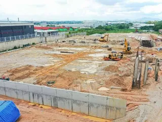
What is Point Cloud Processing?
Learn how point cloud processing improves LiDAR accuracy, supports terrain modeling, and creates CAD and GIS deliverables for engineering and construction projects. ...more
LiDAR Mapping
October 21, 2026•6 min read

What Is Drone Surveying?
Learn how drone surveying uses aerial imagery and LiDAR mapping to capture accurate site data, monitor construction progress, and support land development. ...more
LiDAR Mapping
October 19, 2026•6 min read

What Is LiDAR Mapping?
Learn how LiDAR mapping and drone technology capture detailed terrain data, create 3D elevation models, and support accurate site planning, drainage design, earthwork estimates, and land development. ...more
LiDAR Mapping
October 14, 2026•6 min read

Welcome to LiDAR Mapping Pro: A Better View of Your Project
Discover how LiDAR mapping captures detailed terrain data to support site planning, improve design decisions, and guide construction and development projects. ...more
LiDAR Mapping
October 12, 2026•5 min read




Our Services
Business hours
Mon: 9am to 5pm
Tues: 9am to 5pm
wed: 9am to 5pm
Thurs: 9am to 5pm
fri: 9am to 5pm
Copyright 2026. Auburn Business - CE, LiDAR and Private Utilities. All rights reserved.