
Blogs
Welcome to LiDAR Mapping Pro: A Better View of Your Project
Every project starts with a piece of ground, and that ground rarely looks as simple as it does on paper. Slopes, low spots, trees, and old structures can all change how a design comes together. LiDAR Mapping Pro was built to help teams see those details early, before they turn into costly surprises.
LiDAR Mapping Pro offers three core services. These are LiDAR mapping, drone surveying, and point cloud processing. Each one helps teams in engineering, construction, land development, and infrastructure work. The goal is to turn complex terrain into data you can use to make sound choices.
Why Clear Site Data Matters
Planning goes better when you know what’s on the ground. A site might look flat from the road but drop several feet toward a creek. A wooded lot might hide a drainage path that shapes where water flows after a storm.
Good site data also helps everyone work from the same picture. Engineers, contractors, and owners can review the same terrain and talk through the same questions. That shared view cuts down on guesswork and back-and-forth during design.
Picture a developer looking at a new parcel for homes. Before roads and lots are laid out, the team needs to know where the high and low points are. Clear elevation data can show where grading may be needed and where water may collect.
How LiDAR Mapping Supports Better Planning
LiDAR stands for Light Detection and Ranging. A LiDAR sensor sends out quick pulses of laser light and measures how long each one takes to bounce back. Those timings become millions of measured points that show the shape of the ground and the features on it.
Some pulses can pass through gaps in trees and brush. That means the data can often show the ground surface even where plants cover it. Results still depend on how thick the cover is and other site conditions.
Our LiDAR mapping services give you high-accuracy terrain data for planning and design. We can also build Digital Elevation Models, or DEMs. A DEM is a digital map that shows how high the ground is across a site. Teams use DEMs to study slopes, plan grading, and check drainage.
LiDAR data collection is also fast and efficient. A large area can be captured in far less time than walking it point by point. That speed helps keep early planning on track.
Seeing More With Drone Surveying
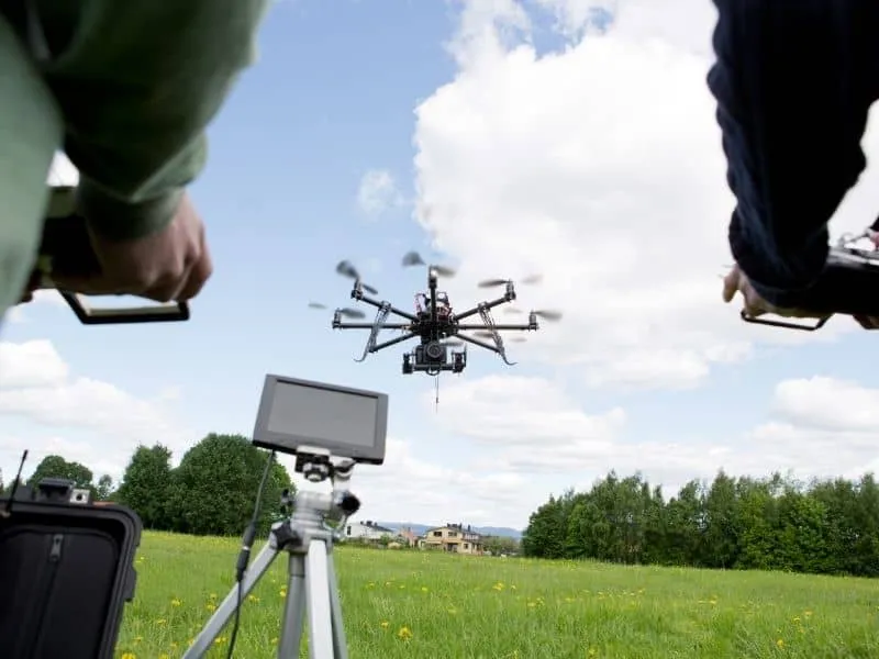
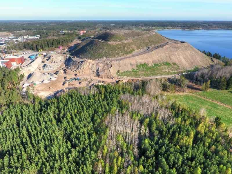
Some questions are easier to answer from above. A drone survey gives you a clear aerial view of a site, along with data you can measure and share. It’s a practical way to review large or hard-to-reach areas without sending crews across every acre.
One key product is an orthomosaic map. This is a large, detailed image made by stitching many drone photos together and correcting them so the scale stays true. You can use it to check site layout, spot visible features, and measure distances on screen.
Drones also support aerial site inspections. They can capture roofs, slopes, stockpiles, and other areas that are slow or risky to reach on foot. Teams can then review the images from the office and decide where to focus next.
On active jobs, our drone surveying services help with construction progress monitoring. Regular flights create a visual record of how work moves forward. Contractors and project managers can compare flights, share updates, and catch issues sooner.
Drone surveying works well alongside other methods. It doesn’t replace every type of traditional land survey, and some tasks still call for ground-based work. Think of aerial mapping as one more useful layer of data for your project.
Turning Point Clouds Into Useful Project Data
A LiDAR scan produces what’s called a point cloud. You can think of it as a 3D picture made of millions of tiny dots. Each dot marks a real spot on the ground, a building, a tree, or another feature.
High-density point clouds hold a lot of detail. On their own, though, they can be large and hard to work with. That’s why point cloud processing matters so much.
Processing cleans, sorts, and organizes the raw data. Ground points can be split from trees and buildings, and unwanted noise can be removed. The result is data that’s easier to read and ready for the next step.
We deliver processed data in CAD-compatible and GIS-compatible files. CAD files fit into the design software that engineers use every day. GIS files work with mapping tools that help teams study land and site features over larger areas.
Either way, the data should slot into the tools your team already uses. Nobody wants to spend hours converting files before real work can start. Clean, usable files help keep design moving.
Supporting Projects With Reliable Mapping Data
LiDAR Mapping Pro supports projects across the United States. That includes engineering, construction, land development, and infrastructure work. Some clients need terrain data for one site, while others need aerial mapping for long corridors or large tracts.
Engineers can use our geospatial data to support design and grading plans. Surveyors may use LiDAR and drone data to add detail to their own field work. Developers can study a property before they commit to a layout, and contractors can track progress as work moves along.
Property owners planning development can benefit too. A clear picture of the land can make early talks with designers and builders more productive. It also helps you ask better questions before money is spent on design.
Across every project, the focus stays the same. We aim to deliver accurate data, communicate clearly, and provide reliable service from start to finish. That way, your team can make choices based on what’s really on the site.
Thanks for visiting LiDAR Mapping Pro. We’re glad to share what we do and how terrain and aerial data can support your next project. Take some time to explore our services and see which ones fit your needs. If you have a site in mind, reach out to talk through your goals and the kind of data that would help most.




Our Services
Business hours
Mon: 9am to 5pm
Tues: 9am to 5pm
wed: 9am to 5pm
Thurs: 9am to 5pm
fri: 9am to 5pm
Copyright 2026. Auburn Business - CE, LiDAR and Private Utilities. All rights reserved.