
Blogs
What Is LiDAR Mapping?
Bad ground data has a way of showing up late in a project. It appears as extra earthwork, a drainage plan that doesn’t drain, or a grading change halfway through construction. LiDAR mapping helps prevent those surprises by measuring the ground in fine detail before design starts.
LiDAR mapping is a way of measuring land and structures with laser pulses. A sensor on a drone or aircraft fires light at the ground and times each return. The result is a dense 3D model of terrain and surface features that teams can design from.
This guide is for land developers, civil engineers, and construction teams. It covers how the technology works, what you get, and when it makes sense. You’ll also learn what to confirm with a provider before any flight is booked.
How LiDAR Mapping Works and Collects Accurate 3D Data
LiDAR stands for Light Detection and Ranging. The sensor sends out many thousands of laser pulses every second. Each pulse hits a surface, bounces back, and the sensor records the travel time.
Light moves at a known speed, so that time converts into a distance. A distance alone isn’t very useful, though. The system also needs to know where the sensor was and which way it pointed.
Two other tools handle that job. A GNSS receiver tracks the sensor’s position, much like a very precise GPS. An inertial measurement unit, or IMU, tracks tilt and rotation, and software combines all three so each return becomes a point with real-world coordinates.
Accuracy isn’t a fixed number. It depends on the sensor, flight height, speed, ground control, and processing. A good provider checks results against surveyed points on the ground and reports how the data measured up.
How Drone LiDAR Mapping Captures Terrain and Surface Features
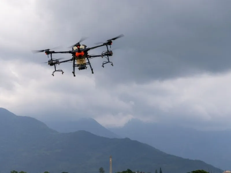
Drone LiDAR mapping mounts the sensor on an unmanned aerial vehicle that flies a planned path over the site. Flying low and slow packs more points into each area. That makes drones a strong fit for small and mid-sized sites.
Vegetation is where LiDAR really pays off. A single pulse can return several echoes, with part hitting a treetop and part reaching the soil below. Those ground returns let processors model bare earth that a camera would never see.
That’s the main difference from photogrammetry. Photogrammetry builds models from overlapping photos and works well on open ground. Under trees or brush, a camera only sees the top of the canopy, so many drone survey projects carry both sensors.
LiDAR has limits too. Water absorbs most of the laser energy, so ponds and streams return little data. Very thick brush can block almost every pulse, and rain, fog, or wind can delay a flight.
Understanding LiDAR Point Clouds and Digital Elevation Models
The raw product of a LiDAR survey is a point cloud. It’s a huge set of points, often millions, each with an X, Y, and Z value. On screen, it looks like a 3D picture of the site built from tiny dots.
Raw points aren’t ready for design work. Processors sort them into classes such as ground, vegetation, buildings, and power lines. This step is called classification, and its quality shapes every product built from it.
From the classified point cloud, teams create elevation models and design files:
A Digital Terrain Model (DTM) shows bare earth with trees and buildings removed.
A Digital Surface Model (DSM) shows the top of everything, including canopy and roofs.
A Digital Elevation Model (DEM) is a broader term that often refers to bare-earth surfaces.
Contour lines turn elevation data into the familiar lines used on grading plans.
Ask which formats your design team needs before data collection. Common requests include LAS or LAZ files, CAD surface files, and contours at a set interval. Settling this early saves rework later.
Common LiDAR Mapping Applications in Construction and Land Development
Most projects use LiDAR mapping to answer one question quickly. What does the ground really look like? That answer feeds grading, drainage, and cost estimates.
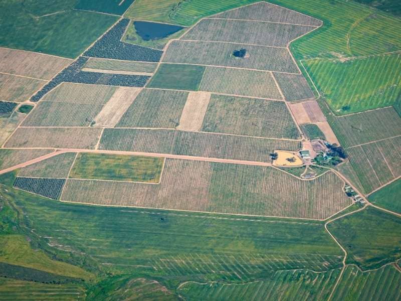
Site feasibility is often the first use. Developers use aerial LiDAR mapping to judge slopes, drainage paths, and buildable areas before buying or planning. Finding a steep ravine early is far cheaper than finding it during design.
Earthwork tracking is another common need. Contractors compare surfaces from different dates to measure cut, fill, and stockpile volumes. Repeat flights show how a site is changing without crews walking every pile.
Drainage and stormwater design benefit from detailed bare-earth models. Engineers can spot low areas, flow paths, and places where water will pond. Wooded sites gain the most because the ground is otherwise hidden.
Long corridors are also a natural fit for an aerial survey. Roads, pipelines, and power lines can stretch for miles over rough ground. LiDAR captures the terrain along with overhead lines, poles, and encroaching trees.
When to Use LiDAR Mapping for Professional Site Planning
LiDAR mapping is the right call when a site is large, wooded, steep, or hard to reach. It also helps when you need terrain data fast or want to limit crew time on unsafe ground. For a small, open lot, a ground survey or photogrammetry may be enough.
LiDAR doesn’t replace licensed surveying. It doesn’t set legal property lines, and many projects still need ground crews for control, boundaries, and fine details like pipe inverts. Requirements vary by project scope, deliverable specs, and applicable rules.
Before booking a drone LiDAR survey, confirm these points with your provider:
The accuracy your design or permit work requires
The coordinate system and vertical datum
Deliverable formats and contour interval
Site access, airspace limits, and landowner permission
Timing, including leaf-off season for heavily wooded sites
Clear answers keep the data usable from day one. They also help you avoid a costly reflight. Bring your engineer into that conversation early.
Frequently Asked Questions
How accurate is LiDAR mapping?
Accuracy depends on the sensor, flight plan, ground control, site conditions, and processing. Dense vegetation and steep slopes can affect results. A reliable provider checks the data against surveyed checkpoints and reports the findings. Ask to see that report before using the data for design.
What’s the difference between LiDAR and photogrammetry?
LiDAR measures distance with laser pulses, while photogrammetry builds models from overlapping photos. LiDAR can reach the ground through gaps in trees and brush. Photogrammetry works well on open sites and produces detailed color imagery. Many projects combine both to get the strengths of each.
Can a drone LiDAR see through trees?
LiDAR can’t pass through solid leaves, but pulses slip through small gaps in the canopy. Some of those pulses reach the ground and return to the sensor. That’s often enough to model bare earth on wooded sites. A very thick brush can still leave holes in the ground data.
How long does a drone LiDAR survey take?
Field time on many sites is a day or less, though larger areas take longer. Processing and classification usually take more time than the flight itself. Weather, airspace approvals, and site access can also affect the schedule. Ask for a timeline that covers both fieldwork and final deliverables.
Does LiDAR mapping replace a land survey?
No, it serves a different purpose. LiDAR mapping measures terrain and surface features, but it doesn’t establish legal property boundaries. Many projects still need licensed surveyors for boundaries, control, and certain fine details. LiDAR works best as one part of a well-planned site data strategy.




Our Services
Business hours
Mon: 9am to 5pm
Tues: 9am to 5pm
wed: 9am to 5pm
Thurs: 9am to 5pm
fri: 9am to 5pm
Copyright 2026. Auburn Business - CE, LiDAR and Private Utilities. All rights reserved.